
A ready-to-use toolbox for the analysis of Earth Observation captures from multiple sources, accumulating GeoKapti's 15+ years of experience working with satellite and geospatial data.
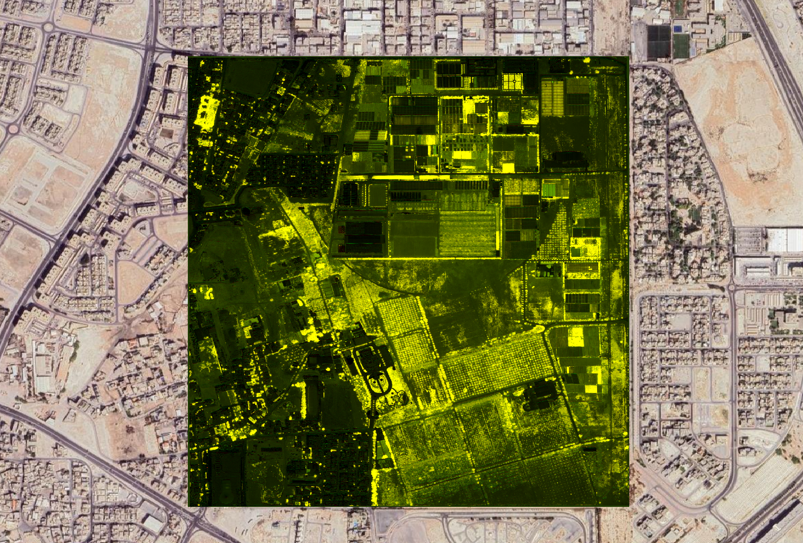
GeoBox comes with everything you need to ingest, process, analyze, and integrate Earth Observation data. Some of its features:
Supports ingesting multiple spectral bands including optical, from Copernicus, Landsat and commercial provides of multiple resolutions.
Can process raw complex components and generate filtered intensities, polarization ratios, coherence, texture factors and others.
Support for thermals readins from Sentinel-3, SatelliteVU and others. GeoBox can upscale the Sentinel-3 LST with artificial intelligence to 30m.
Resampling, regridding, reprojection. Seamlessly stack multiple dates in a datacube for analysis ready data (ARD)
Can read Geotiff and netcdf. Can output netcdf in standard format readable by ArcGIS or QGIS. Zarr on the works.
Installable as a python package and usable from a CLI for all operations. LIbrary & API for integrations.
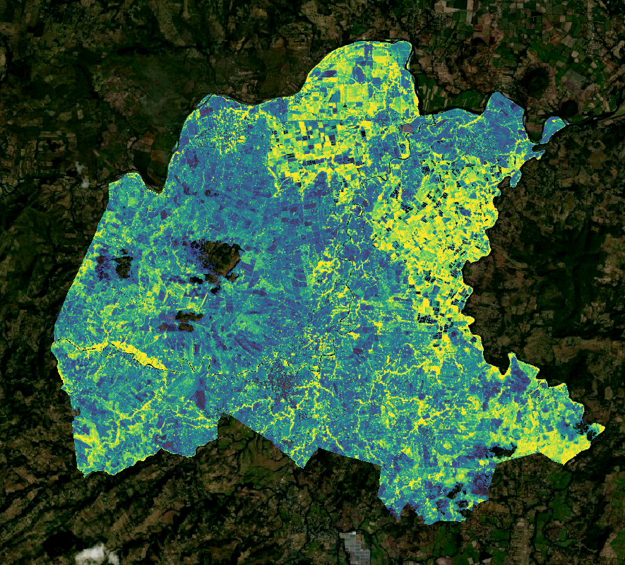
We have worked with municipalities in Central America to offer a variety of monitoring solutions based on EO data. In Colombia we monitored deforestation in te vast provinces with the Amazon Rainforest. In Mexico, we surveyed towns with large production of avocado and in El Salvador we provided year long readings to understand the effects of policy and irrigation.

GeoKapti has helped trading companies track the production of quinoa in the Andes mountains. It is a super food and 147,000 tons of quinoa were consumed globally in 2024.The best quality comes from Peru, Bolivia and Ecuador, where it is difficult to track in the vast expanses of the mountains at over 3000m of altitude.
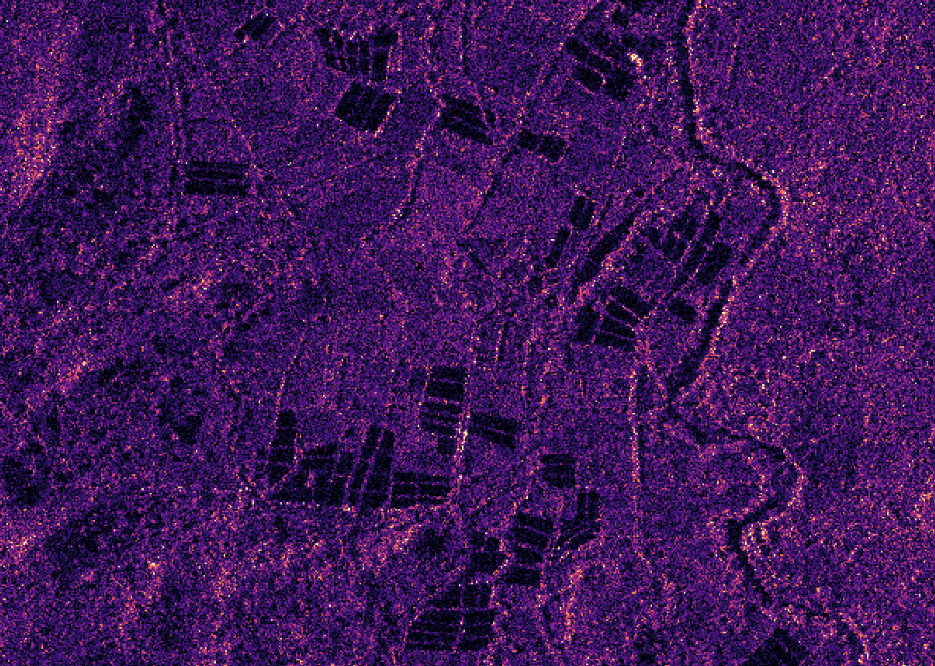
Tracking illegal human activity is almost impossible for small towns and provinces with a vasta territory. Field inspections are rare and insufficient. For municipalities in Central America we have helped them detect illegal shrimp pools using Synthetic Aperture Radar. The pools stand out as dark blocks in the radar backscatter.
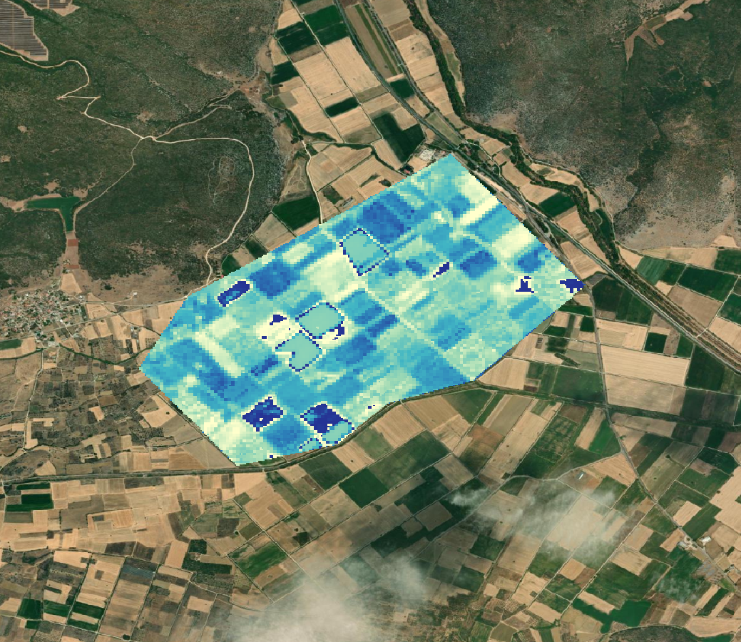
The European Space Agency has trusted us to estimate evapotranspiration from space using a fusion of data from different instruments in space: multispectral captures and thermal readings. We then use AI and a physical model that takes them as inputs, along with weather, elevation and sun angle to estimate evapotranspiration in the Spercheios Basin of Central Greece.
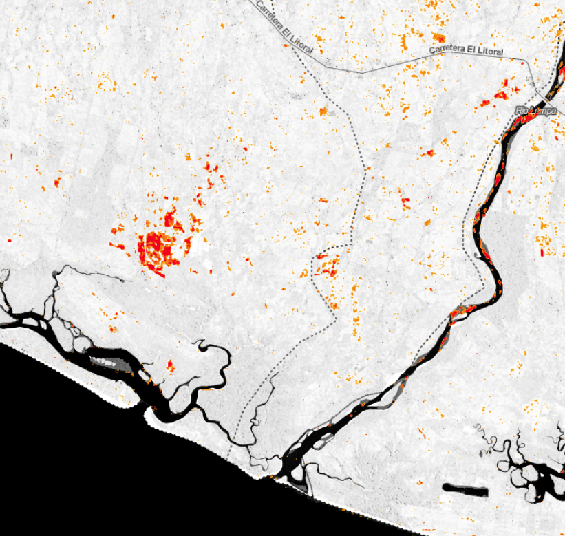
The image shows the damage map developed for the Ministry of the Environment and Natural Resources of El Salvador, to asses the impact after Tropical Storm Amanda hit the country in 2022. We provided nation-wide coverage using Sentinel-1 captures with a variety of metrics calculated before and after the storm.
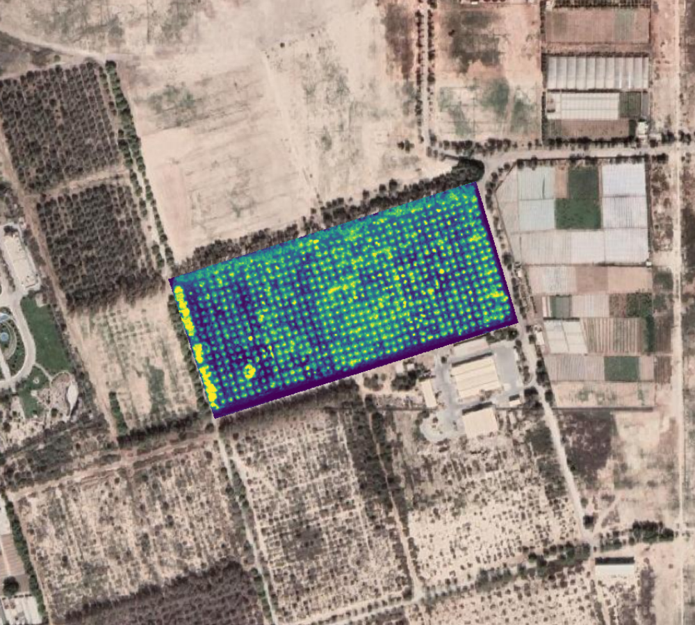
In Bahaerian we provided tree counting servces for citrus orchards. In Mexico we provided tree counting services for avocado farmers associations. The information helped them optimize the application of water and fertilizer. High resolution multispectral data and SAR provided the inputs nd Geobox generated the results.
We can be your strategic partner adding satellite intelligence to your processes. With Geobox it can become a seamless step of your workflow and a strategic input for your decisions.